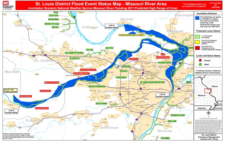
Above: A National Weather Service map of projected flooding along the lower Missouri River, based on an average amount of summer rain, falling in a concentrated time period. This map assumes a river elevation of 37 feet at St. Charles, three feet below the 1993 record. Flood stage at St. Charles is 25 feet. Click here to see a larger version of the map.
The U.S Army Corps of Engineers says we can expect only minor flooding along the lower Missouri River if we get average rainfall through August - but, a stormy summer could change all that.
Record-high releases from the Gavins Point Dam on the Missouri River in South Dakota are expected to reach St. Louis late next week.
The commander of the Corp's St. Louis District, Colonel Tom O'Hara, says that shouldn't cause much flooding in our area - as long as we don't get too much rain.
"The risk would come in if we get a concentrated rain event, or we get above normal rainfalls over the next 60-day period," O'Hara said.
Based on National Weather Service estimates, heavy summer rains would flood agricultural bottom land along the Missouri River from Washington, Mo., downstream.
Suburban areas protected by higher levees are not expected to flood.


